**FREE - Everything on this adventure is FREE**
*Packed food plus gas*
Natchez Trace Parkway - Mile Post 341.8 to Mile Post 444
*Packed food plus gas*
Natchez Trace Parkway - Mile Post 341.8 to Mile Post 444
This trip is planned from Jackson, TN. It can be revised to fit your location.
For this trip it is imperative that you get yourself a Natchez Trace Parkway brochure/map.
One you learn how to navigate it, this is a really helpful site: Natchez Trace Travel
Day One:
7am - Leave Jackson, TN
9:30am to 10:30am - Wichahpi Commemorative Stone Wall - County Road 8, Lauderdale, AL
Hours: No hours are listed but this is on private property (Tom leaves on the property). I imagine it's a 7am to Sundown timeframe. We got there at about a quarter after 9am and he was out there working on the wall.
Admission: Free but donations are greatly appreciated. All he really wants is your respect and time.
 |
| This memorial is really worth the trip. It's not just bricks and stones, it is truely a piece of art. |
On this trip, we started a new family adventure of Geocaching...this was our first find ever...
 |
| Micro Cache |
The stops from here on do not have any hours or admission unless otherwise stated...however, most are trails are varying distance into wooded areas and wouldn't be much to see in the dark.
These stops all have turn offs or parking areas so you are not stopping in the road to see the attractions closer.
10:35am to 10:40am - Alabama-Tennessee State Line - MP 341.8
 |
| September 2 2012 |
There are a few other stops along the way that we chose to past for lack of time and interest. I will add those stops throughout this post in RED.
Mile Post 343. 5 - Cypress Creek
Mile Post 346.2 - Holly
Mile Post 350.5 - Sunken Trace
Mile Post 352.9 - McGlamery Stand
11:00am to 11:30am - Wayne County Visitor Center - 219 East Broadway St, Collinwood, TN
11:45am to 12:15pm - Sweetwater Branch - MP 363
We ate a packed lunch in the parking area before heading out on this trail.
 |
| The kids had a great time playing in this little creek and then we walked the short trail reading all the signs as we went. |
12:20pm to 12:35pm - Glenrock Branch - MP 264.5
 |
| The photos of all these places don't really do justice to the surroundings. |
MP 367.3 - Dogwood Mudhole
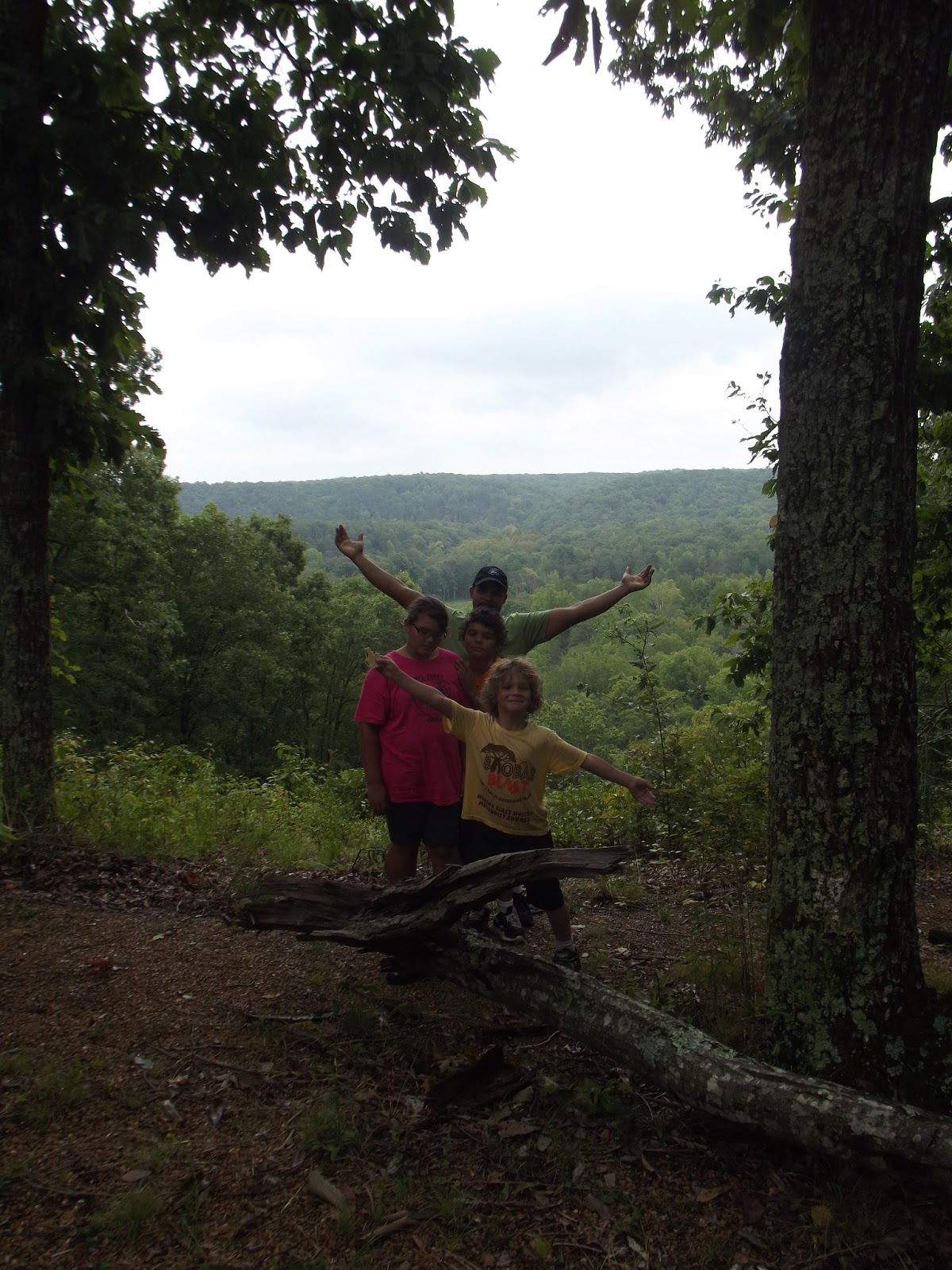
12:50pm to 1:00pm - Old Trace Drive - MP 375.8
This is a 2.5 mile drive on the original route. The ride is a bit rough but the view is beautiful.
 |
| It was a bit rainy and dreary out today. |
1:05pm to 1:20pm - Jacks Branch - MP 377.8


Mile Post 381.8 - Napier Mine
1:35pm to 2:30pm - Metal Ford and Buffalo River - MP 382.8
McLish Stand Exhibit and Steele's Iron Works


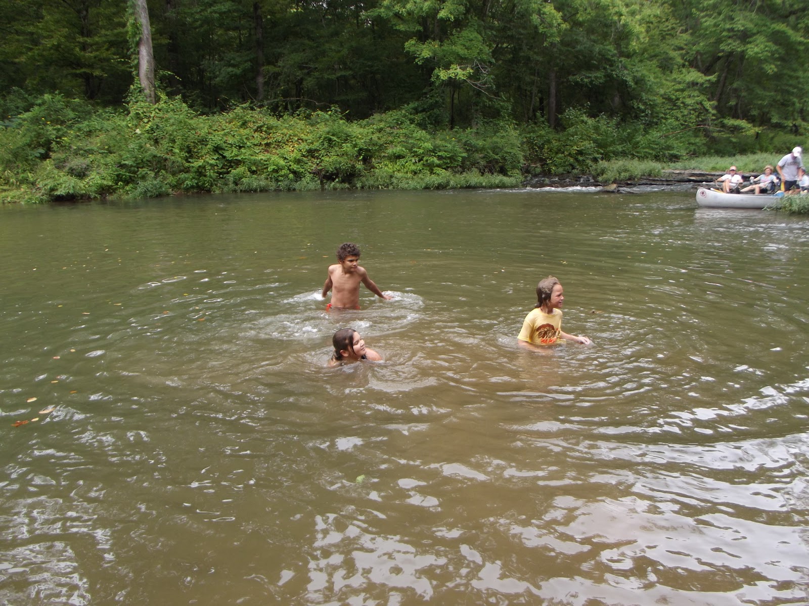

The kids could have stayed at this stop all day...because we had never been to any of the places on our trip I wasn't sure of the time to allow so we only stayed an hour but the kids were mad when I pulled them out.
This location also had a little trail but we didn't take it. We got out of the car and they saw the water and were gone. By the time they got out, they were too cold to walk a trail and there shoes were all wet anyway.
2:45pm - Meriwether Lewis National Monument - MP 385.9
Visitor Center Hours: Wednesday thru Friday 1pm to 5pm, Saturday and Sunday 9am to 5pm
Admission: Free
Meriwether Lewis Campground - Free - First Come First Serve
This was our first time ever camping. I was all kinds of prepared though...even with the weather calling for a crazy storm coming. I had a list of hotels that were within 30 minutes and another campground in case this one was full. We were also only about 2 hours from home at this point so we weren't worried.
We set up our campsite, had dinner...


Then we headed out on what we thought was going to be a short hike...


But we let the 7 year old be in charge of the map and lead the way, then it started to rain and our map was virtually unreadable...and we ended up getting lost and it ended up to be a bit longer than we thought. It was really only about an hour but an hour seems like a lot longer when you are lost in the woods in the rain and it's starting to get dark out. But we soon found the road and walked back to our campsite to roast marshmallows and make S'mores.

Other Lodging Options:
Fall Hollow Village Campground -MP 391 - privately owned - 931-796-1480
Day 2:
8:00am - Leave Campground
8:05am to 8:20am - Phosphate Mine - MP 390.7
8:30am to 9:30am - Fall Hollow Waterfall - MP 391.9
There are actually more than one waterfalls here...2 bigger ones and a couple small ones. The kids had a super fun time getting all wet right away in the morning.


Parts of the trail are sheets of limestone you have to walk on and limestone 'stairs'...some of which are really slippery so use caution.
MP 392.5 - Swan View Overlook
MP 394 - Devil's Backbone State Natural Area
MP 397.4 - Old Trace
MP 400.2 - Sheboss Stand
9:40am to 9:50am - Tobacco Farm - MP 401.4

 This is an currently working tobacco farm. There is a small patch of tobacco plant growing and a barn used to dry out the tobacco once it is harvested. There is also a 2 mile Old Trace Drive but we did not take it.
MP 403.7 - Old Trace Walk
10:00am to 11:00am - Jackson Falls - MP 404.7
This was our favorite stop of the weekend...at least it was mine. It was way better than I imagines. We would have stayed longer but a man came down with camera equipment and the kids kept getting in his way and we'd been there an hour already so we decided to continue on our adventures.
2:45pm - Meriwether Lewis National Monument - MP 385.9
Visitor Center Hours: Wednesday thru Friday 1pm to 5pm, Saturday and Sunday 9am to 5pm
Admission: Free
 |
| This is the actual gravesite of Meriwether Lewis of Lewis and Clark. |
Meriwether Lewis Campground - Free - First Come First Serve
This was our first time ever camping. I was all kinds of prepared though...even with the weather calling for a crazy storm coming. I had a list of hotels that were within 30 minutes and another campground in case this one was full. We were also only about 2 hours from home at this point so we weren't worried.
We set up our campsite, had dinner...


Then we headed out on what we thought was going to be a short hike...


But we let the 7 year old be in charge of the map and lead the way, then it started to rain and our map was virtually unreadable...and we ended up getting lost and it ended up to be a bit longer than we thought. It was really only about an hour but an hour seems like a lot longer when you are lost in the woods in the rain and it's starting to get dark out. But we soon found the road and walked back to our campsite to roast marshmallows and make S'mores.

Other Lodging Options:
Fall Hollow Village Campground -MP 391 - privately owned - 931-796-1480
Day 2:
8:00am - Leave Campground
8:05am to 8:20am - Phosphate Mine - MP 390.7
8:30am to 9:30am - Fall Hollow Waterfall - MP 391.9
There are actually more than one waterfalls here...2 bigger ones and a couple small ones. The kids had a super fun time getting all wet right away in the morning.


Parts of the trail are sheets of limestone you have to walk on and limestone 'stairs'...some of which are really slippery so use caution.
MP 392.5 - Swan View Overlook
MP 394 - Devil's Backbone State Natural Area
MP 397.4 - Old Trace
MP 400.2 - Sheboss Stand
9:40am to 9:50am - Tobacco Farm - MP 401.4

 This is an currently working tobacco farm. There is a small patch of tobacco plant growing and a barn used to dry out the tobacco once it is harvested. There is also a 2 mile Old Trace Drive but we did not take it.
MP 403.7 - Old Trace Walk
10:00am to 11:00am - Jackson Falls - MP 404.7
This was our favorite stop of the weekend...at least it was mine. It was way better than I imagines. We would have stayed longer but a man came down with camera equipment and the kids kept getting in his way and we'd been there an hour already so we decided to continue on our adventures.


MP 405.1 - Baker Bluff Overlook
11:10am to 11:40am - Gordon House and Duck River Ferry Site - MP 407.7


You can't go in the Gordon House...this is all there is. A short walk will take you to the Duck River Ferry Site...where we learned to skip rocks.
MP 411.8 - Water Valley Overlook
MP 423.9 - Tennessee Valley Divide
MP 425.4 - Burns Branch
12:05pm to 2:00pm - Old Trace - MP 426.3
 |
| September 3 2012 |


2:20pm to 2:30pm - Birdsong Hollow and Highway 96 Double-Arched Bridge - MP 438
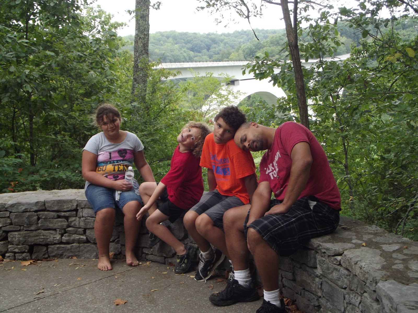
MP 444 - Northern Terminus
This was the end of our trip. We had originally planned on stopping at the Loveless Cafe (8400 TN Hwy 100, Nashville, TN) but we had not planned on it raining all weekend and being as wet and dirty as we were. So we went to McDonalds instead...then headed the 2 hours home.